
Summary
Using a series of NASA images, the student will explore some properties of the lunar surface
Background and Theory
From 1966-1968, a series of five spacecraft, named Lunar Orbiters 1-V, was launched for the purpose of mapping the lunar surface in order to select landing sites for the Apollo missions. All five spacecraft were very successful, resulting in thousands of high-quality black and white images of nearly the entire lunar surface, including the first detailed pictures of the far side.
Many geologic features can be observed in these images. Craters are generally round depressions in the surface, caused by the impact of meteors or other space debris. Maria are the dark places on the Moon. These were originally thought to be seas, hence the name, which means "sea" in Latin. However, they are actually basaltic lava deposits on the surface left over from a time when the Moon was still geologically active.
Procedure
Print out the answer sheet, and the map of the full moon.
- Examine the image of the full moon. Identify the following features using your map:
CRATERS: Tycho, Copernicus, Kepler, Plato, Aristarchus.
MARIA: Imbrium, Crisium, Serenitatis, Tranquillitatis, Nectaris, Oceanus Procellarum.
From these observations, give a brief description of a crater and a mare.
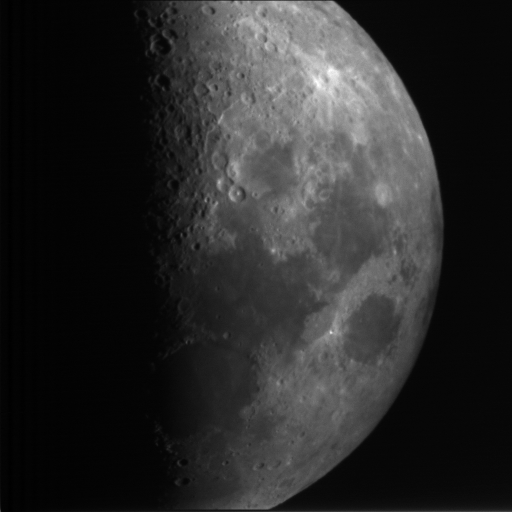
- This image of the moon at first quarter was taken by a small telescope on the ground (the Automated Telescope Facility). Which side of the portion of the Moon that we see is lit first after a new moon?
- This image shows one of the Lunar Orbiter spacecraft. What is the purpose of the four flat panels on the sides?
- Compare this image with the map of the full Moon. Do you think this image was taken from the Earth? Why or why not?
- Examine these images of the six successful Apollo missions (Apollo 13 didn't make it to the lunar surface). The paths of the excursions taken by astronauts across the Moon's surface are also shown. Make a table giving the image name and a brief description of the terrain near the landing site. Do you think the Apollo planners picked a reasonable range of sites to sample the lunar surface? Why or why not? Why are all the landing sites on the near side of the Moon?
- This picture was taken from the Moon, looking toward the Earth. Make a drawing based on this picture which includes the Earth, the Moon and the Sun. At what phase(s) could an Earth-based observer have seen the Moon when this image was taken?
- Tycho is probably the most easily recognized crater. Examine these 5 images. Record the crater's diameter and the height of its walls using this image. Make a sketch of the Earth-Moon-Sun geometry when this image was taken. From the position and length of the wall's shadow, determine the phase of the Moon when this picture was taken.
- Copernicus is another conspicuous crater, located in Mare Imbrium. Look at these 8 images. Measure the diameter of Copernicus (in pixels). (Need help remembering the distance formula? Check this review.)
- The image scale is 800 meters per pixel. From this, determine Copernicus' diameter in kilometers (1 km = 1000 m).
- On some of the Copernicus images, it is possible to see that the walls are terraced. How many terraces do you see on Copernicus' walls?
- Determine the height of each terrace (in pixels). Convert this distance to kilometers. (Note that the image scale is not the same as above. You will have to calculate an approximate image scale from the height of the peak in the foreground.) Terraces are a common feature of many large craters---for another example, look at the crater Theophilus.
- At the edges of lunar maria, there are often damaged walls of craters formed before the maria. Look at Palus Epidemiarum (the Marsh of Epidemics) and several damaged craters on the periphery. What do you think caused the damage?
- Some lunar features are quite unusual. Look at this chain of craters. Can you think of a reason for the craters to be in such a nice straight line?
© 2003 Weber State University
Revised: 24 April, 2003
